DS07

Site code DS07
Location Cotobade
Region Galicia
Country Spain
Local name Santiago de Loureiro
Partner CIF
Site characteristics
Orientation: W, Slope:30.0°, Soil :UMBRISOLS, Bedrock : acid regional metamorphic rocks
PH :4.6,
Hydrology
Middle slope in the river Lerez basin and 20 km far from Atlantic coast
Short History of the site
 copyrigth IEFC network
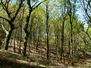
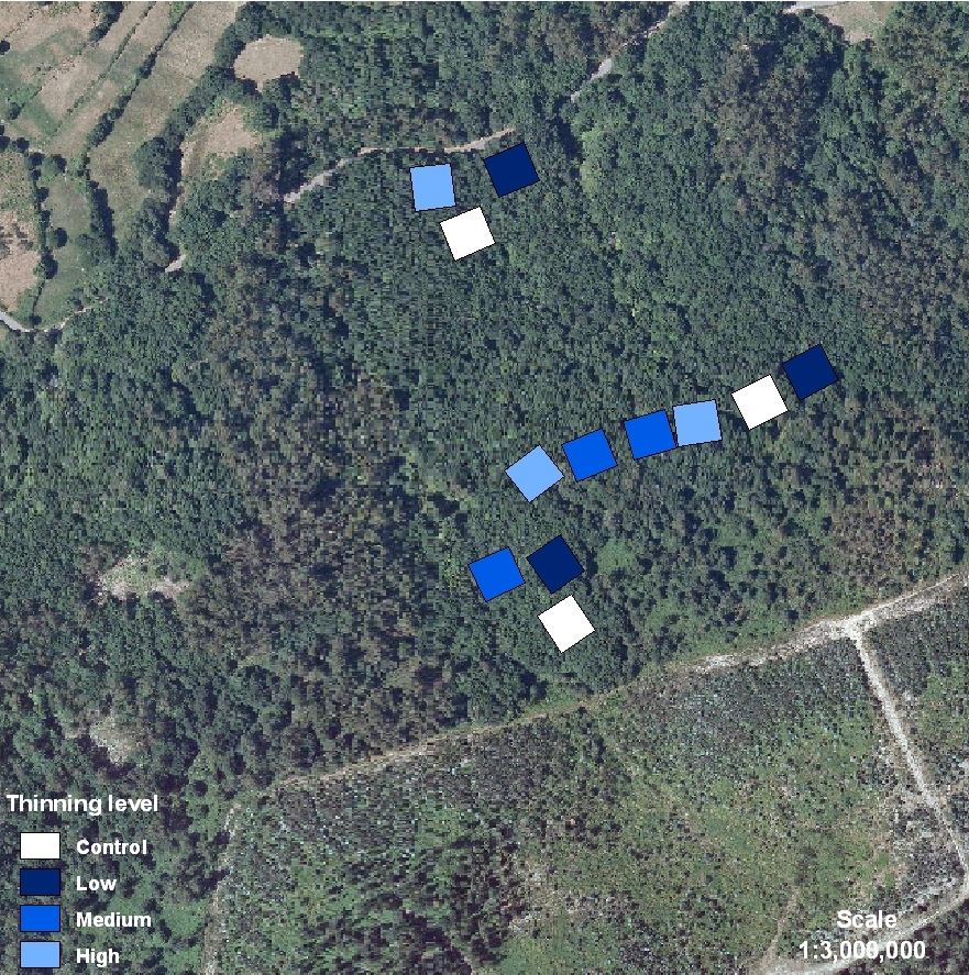
The stand shows an uneven-aged oak (Quercus robur L.) canopy covering a sparse understory mainly with grasses and some shrubs (holly trees, chestnuts, heaths and gorses). Initially, tree stand characteristics were: Age (32 years), Mean DBH (22.5 cm), Mean Height (14.8 m), Density (1000 tree/ha) Thinning treatments were applied in 1999. The stand is surrounded by pastures and orchards and occasionally some trees were removed mainly for fuel by the nearest neighbors. DS07 is placed on a private land. The land is owned and managed by a Neighborhood Forest Association, typical of Galician culture. All the forest area belongs to a territorial demarcation, parroquia, which joins all the neighborhood members. Each citizen owns a percentage of the whole indivisible forest area and the management must be agreed with all the members of the community by a common consent. In Galicia, this way of forest property is called Neighborhood Forest in Common Hand. We asked for the permission to the Neighborhood Forest of Loureiro, and they, by common consent, gave us a permission to establish the experience.
La superficie está ocupada por una masa irregular de roble (Quercus robur L.) que domina sobre un sotobosque ralo formado por plantas herbáceas y algunos arbustos (acebos, castaños, brezos y tojos). Las características iniciales de la masa fueron: Edad (32 años), DBH medio (22.5 cm), Altura media (14.8 m), Densidad (1000 pies/ha) La masa está rodeada de pastos y huertos y suministra leña para las casas próximas. La finca es de propiedad privada. Está gestionada por una Comunidad de Montes Vecinales en Mano Común que además tiene la propiedad del terreno y que constituye un régimen de propiedad característico en los montes gallegos. Todo el monte pertenece a la parroquia, que incluye a todos los vecinos. Cada parroquiano posee un porcentaje de toda la superficie forestal indivisible que se gestiona de común acuerdo. Se ha solicitado permiso para hacer la clara a la CMVMC de Loureiro y, de común acuerdo, han permitido al CIF hacer el tratamiento de clareo en 2ha de superficie forestal.
